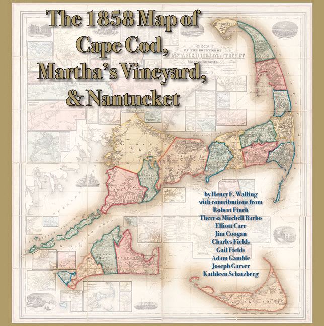
The 1858 Map of Cape Cod, Martha's Vineyard, and Nantucket
by Joseph Garver (Preface by), Adam Gamble (Editor), Henry F. Walling (Illustrator)
ISBN-10: 0978576675
ISBN-13: 9780978576677
$50.00
Book Specs
Binding
Trade Paper
Publisher
On Cape Publications
Published on
Nov 15, 2009
Edition
st Edition
Dimensions
12.50x0.70x12.50 Inches
Weight
2.16 Pounds
About the Book
Based on the five-foot by five-foot 1858 Map of the Counties of Barnstable, Dukes, and Nantucket Counties by Henry F. Walling, this display-style book showcases each county, town, village, and the major bodies of water that surround and connect them. It includes each home and business, road by road, complete with the names of property owners and important geographic features, as well as useful tables of statistics and delightful period illustrations. Originally produced at the end of the Great Age of Sail, at a time when whaling and salt-making were still strong industries in the region, this gorgeous wall map depicts Cape Cod, Martha's Vineyard, and Nantucket at an industrial apex. By publishing the map in book form, by including commentary from some of the region's most insightful writers and scholars, and by utilizing photographs of three different originals, the publishers and designers are able to enlarge and showcase each portion of the map on separate pages and page spreads. The result is that readers are able to view and understand 19th-century Cape Cod and the Islands with a level of detail that is nothing short of celebratory.